
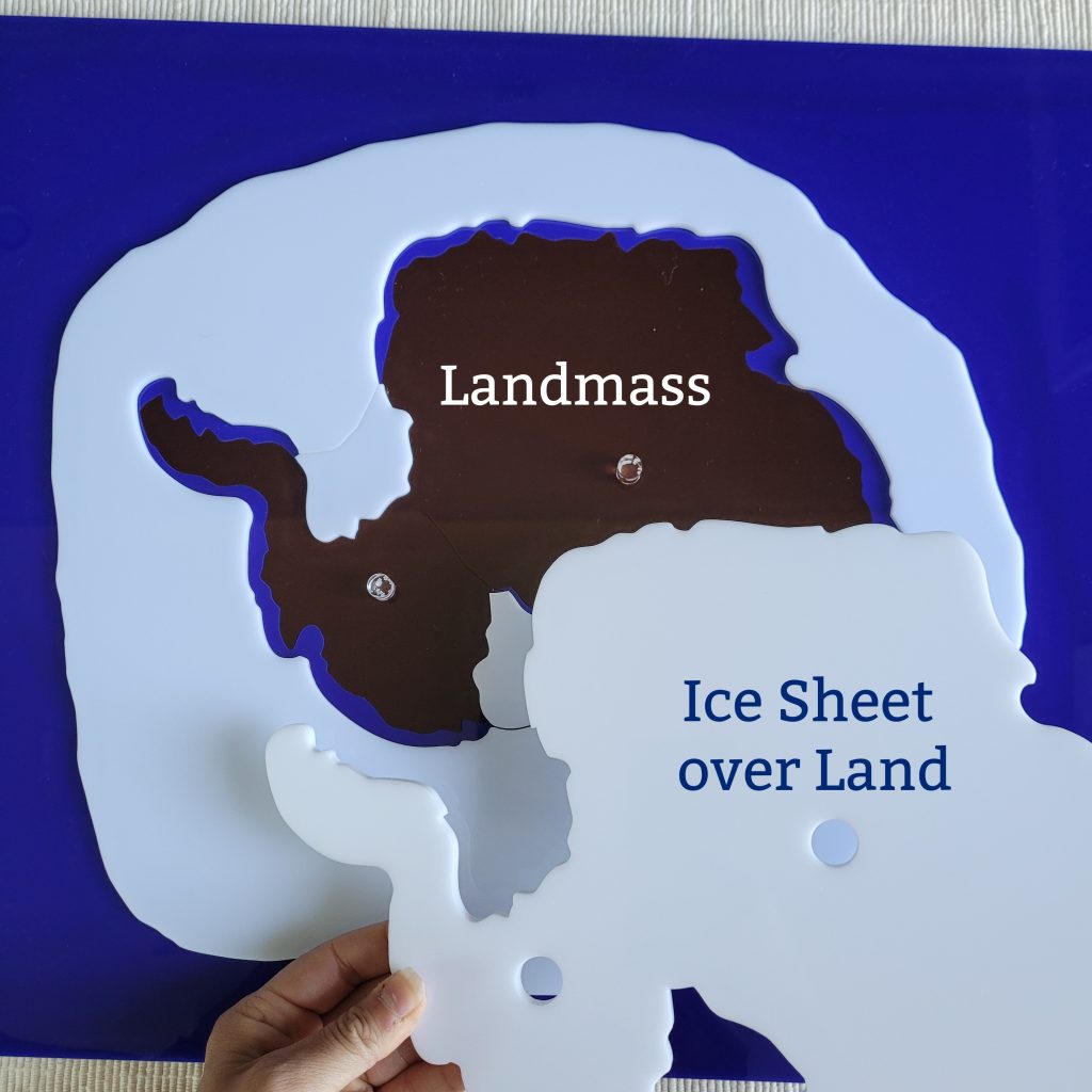
Antarctica is the southmost and coldest place on Earth. It can hold up to 90% of the world’s fresh water, and 92% of its landmass is covered with ice as deep as 4km. As an uninhabited ice-covered landmass, the continent of Antarctica has been coveted by many countries for its natural resources and potential discoveries.
It is the fifth-largest continent in the world, twice the size of the continent of Oceania. It is a desert and mountainous area with little precipitation and if any, it comes down as snow. There are only 2 seasons, winter and summer which greatly affects the snow accumulation and melting snow periods. Although Antarctica is not governed by any country, many places are named and claimed by some countries where they conduct scientific research.
which children can visualize and remove
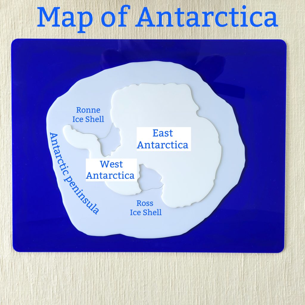
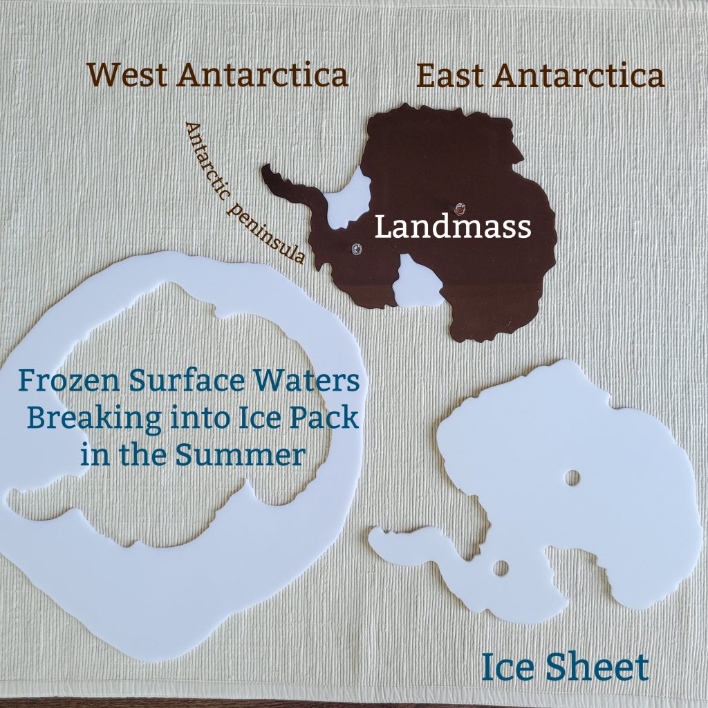
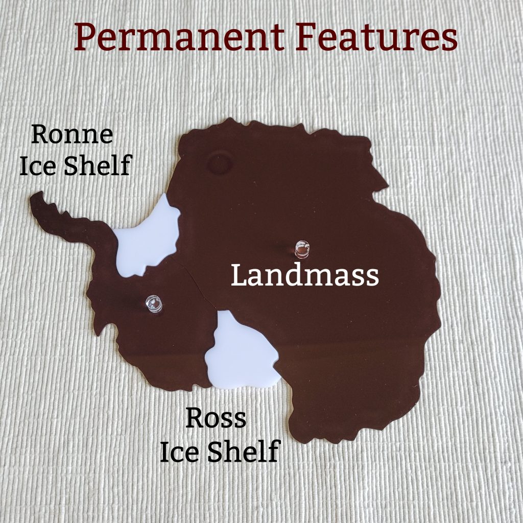
Antarctica is comprised of two main regions; Greater Antarctica (East Antarctica) and the Lesser Antarctica (West Antarctica). There is no north direction in Antarctica since it is the southmost part of the world; however, based on the prime meridian, we can talk about west and east regions. In addition to the landmass are two ice shelves: the Ronne ice shelf and the Ross ice shelf which are permanent thin ice sheets over water.
In the winter, the waters around Antarctica freeze which doubles the size of the continent. In the summer, this part of Antarctica is named pack ice since large slabs of ice break into small parts drifting away into the oceans.
Material
Our exclusive Plastic Puzzle Map of Antarctica (Premium Quality) contains all the movable parts to introduce the different features of Antarctica. Our puzzle has been designed by Laughing Star Montessori and is available exclusively through Alison’s Montessori. For your convenience, you will find a lesson plan which covers all the terminology necessary during a presentation. When working with the puzzle map, children will learn the following parts:
- Landmass
- Ice sheet
- Ice shelf
- Pack Ice
You may also mention:
- East and West Antarctica
- Prime meridian
- Antarctic peninsula
- Antarctica Seasons
- Reflective ice cap
- Mountains and Desert
- Precipitation
- Fauna and flora
- Scientific bases
- Floating ice pack
- Melting snow
- Ice depth
Prior to presenting the lesson, you may want to gather some literature on Antarctica and craft materials to create maps. Following the presentation, you may invite children to research interesting facts about Antarctica.
Our Map of Antarctica guarantees that children will explore and truly appreciate the 5th largest continent of the world. There is so much more to learn about Antarctica. Using a physical map is a great start! For more materials on Antarctica, please visit our website!