Montessori learners are well accustomed to the geographical and political features of the world. They’ve explored various biomes with abundant flora and fauna, political boundaries, and cultural variations in particular regions.
With our brand-new exclusive material, the Nile River Basin, we want to expand the elementary learners’ perspective and invite them to discover the profound impact of the Nile River on the development of Africa. The river has provided a source of water, irrigation, and transportation for centuries and has also played a role in developing trade and culture. This knowledge will consolidate the study of ancient Africa and provide a platform for the work on geometry. In effect, the ancient Egyptians needed to accurately measure the area of their land after each flood in the Nile River Basin, so they developed several geometric techniques.
Materials
or sold separately:
Through the study of the Nile River basin, learners can also expect to reflect on the impact of human activities on the environment by learning about the Aswan Dam and on the implications of sharing a natural resource with other countries as the Nile River crossed not less than 11 countries! Nile River Basin also makes excellent connections between natural occurrences such as the water cycle and the leeward effect in mountainous areas. For instance, Lake Victoria is surrounded by mountains and hills, which help to create moist winds that blow over the lake. The winds can cause thunderstorms and heavy rainfall, which partly feed the Nile River.
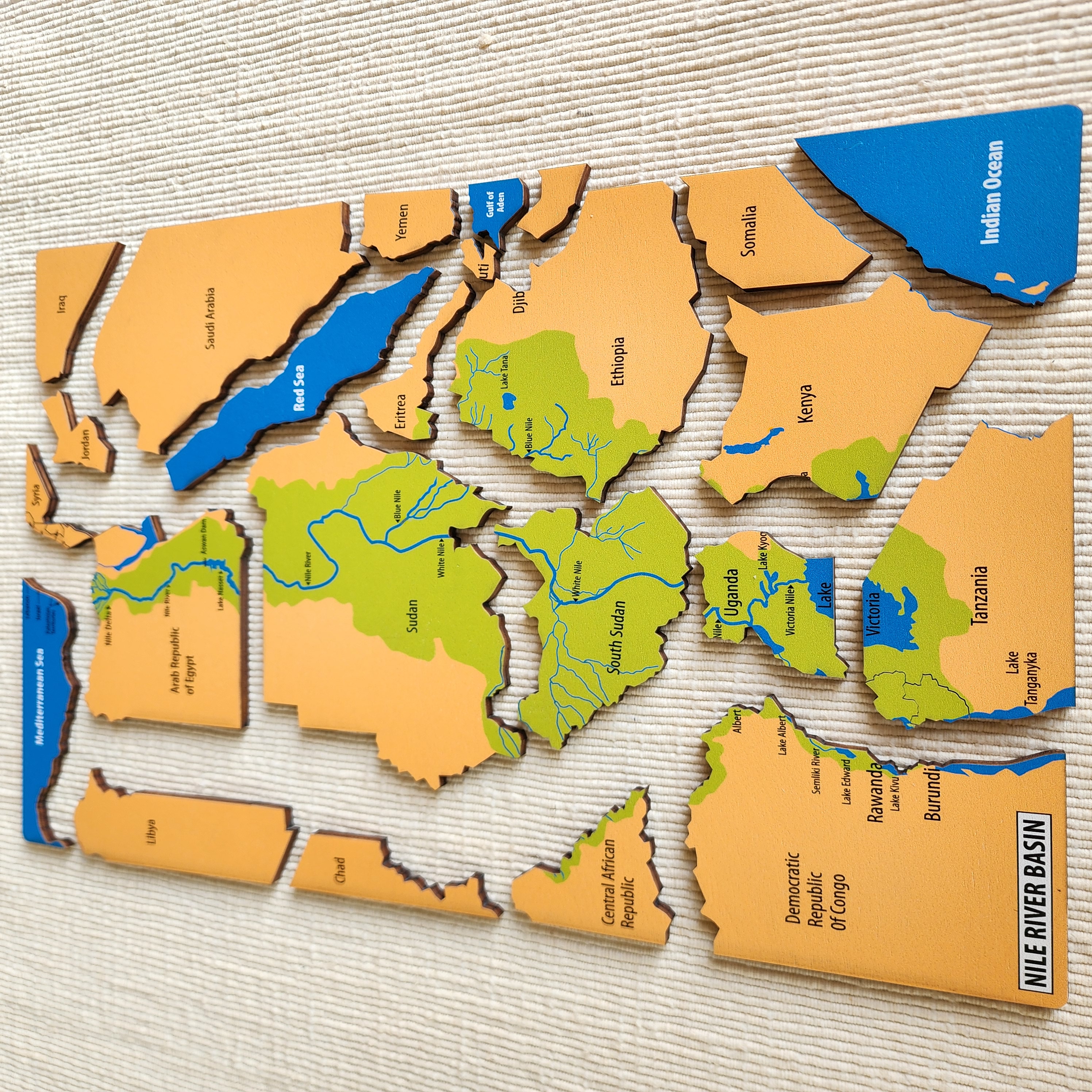
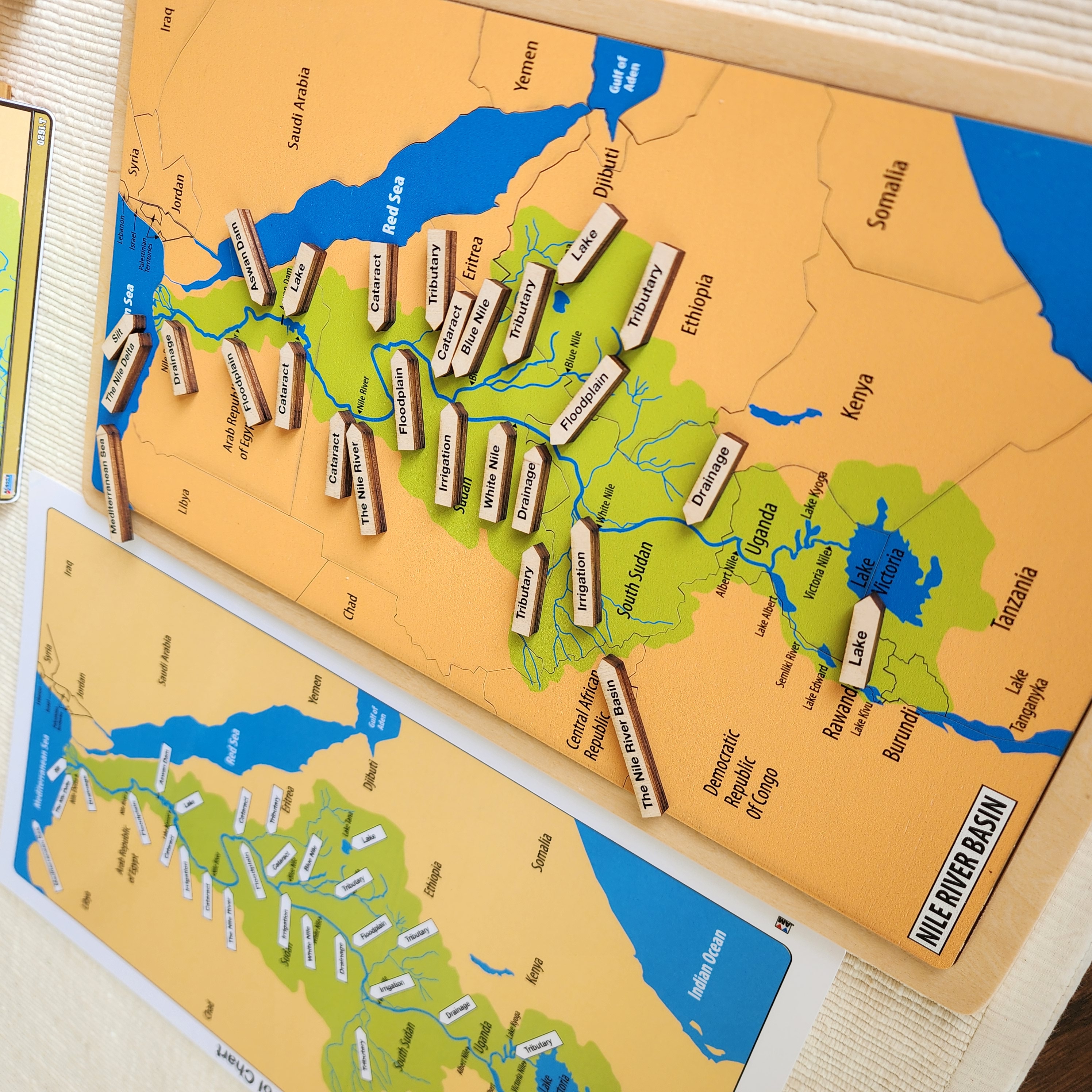
Elementary learners likely assume that the Nile River descends from the Mediterranean Sea to the rest of Africa! Our Research Cards and Task Cards ensure that learners understand that the Nile River source begins in two primary sources: the White Nile and the Blue Nile. The White Nile is the longer of the two rivers and originates in Lake Victoria. The Blue Nile is shorter, but it is much more powerful, and it originates in the Ethiopian Highlands. Learners will also appreciate that our puzzle presents very subtle political boundaries, which let them understand Africa based on geographical features. The puzzle can be taken apart to visualize each labeled country (as seen in the picture above). Unlike the biome puzzle maps, this puzzle uses more natural colors to provide a realistic impression of Africa’s mountains, deserts, and water features.
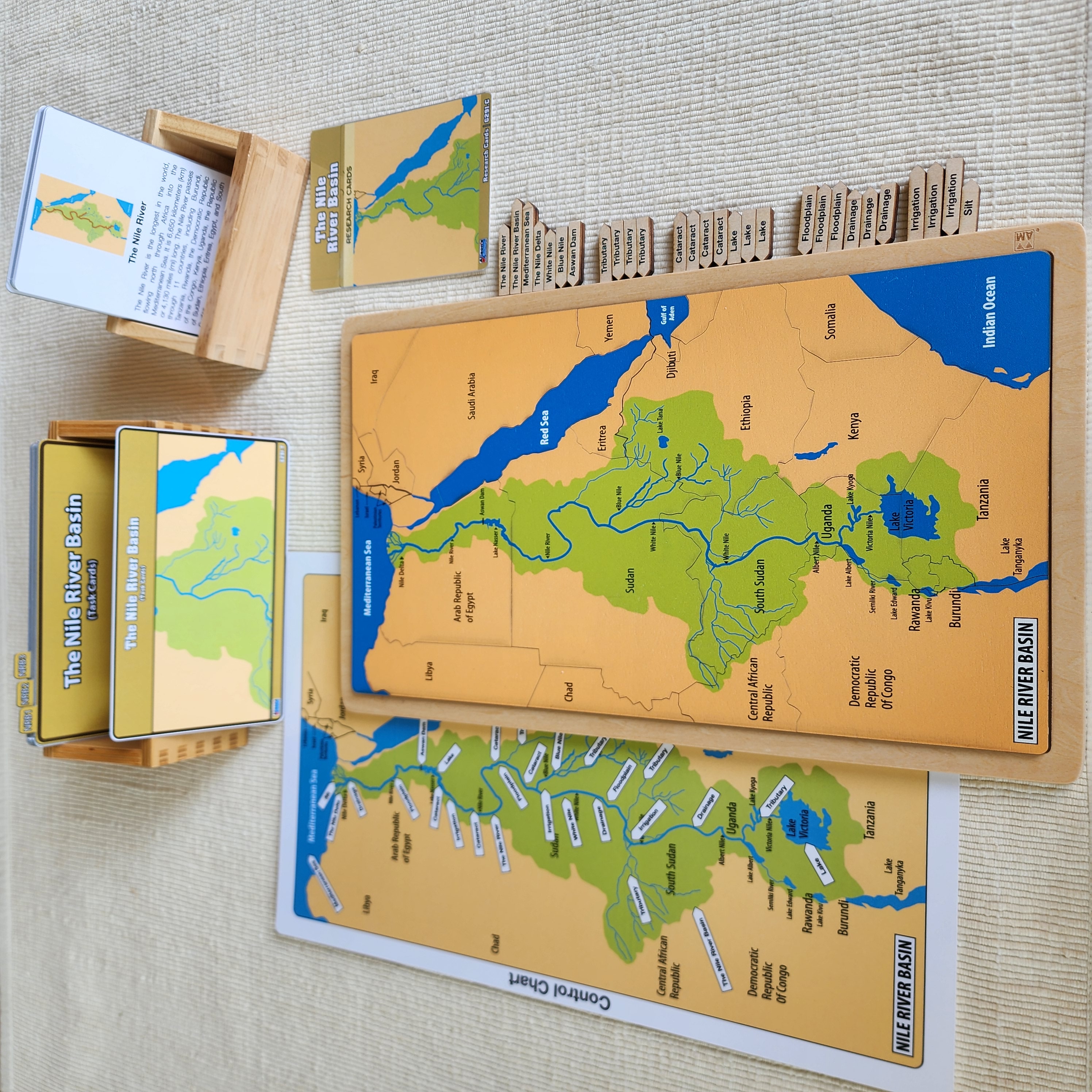
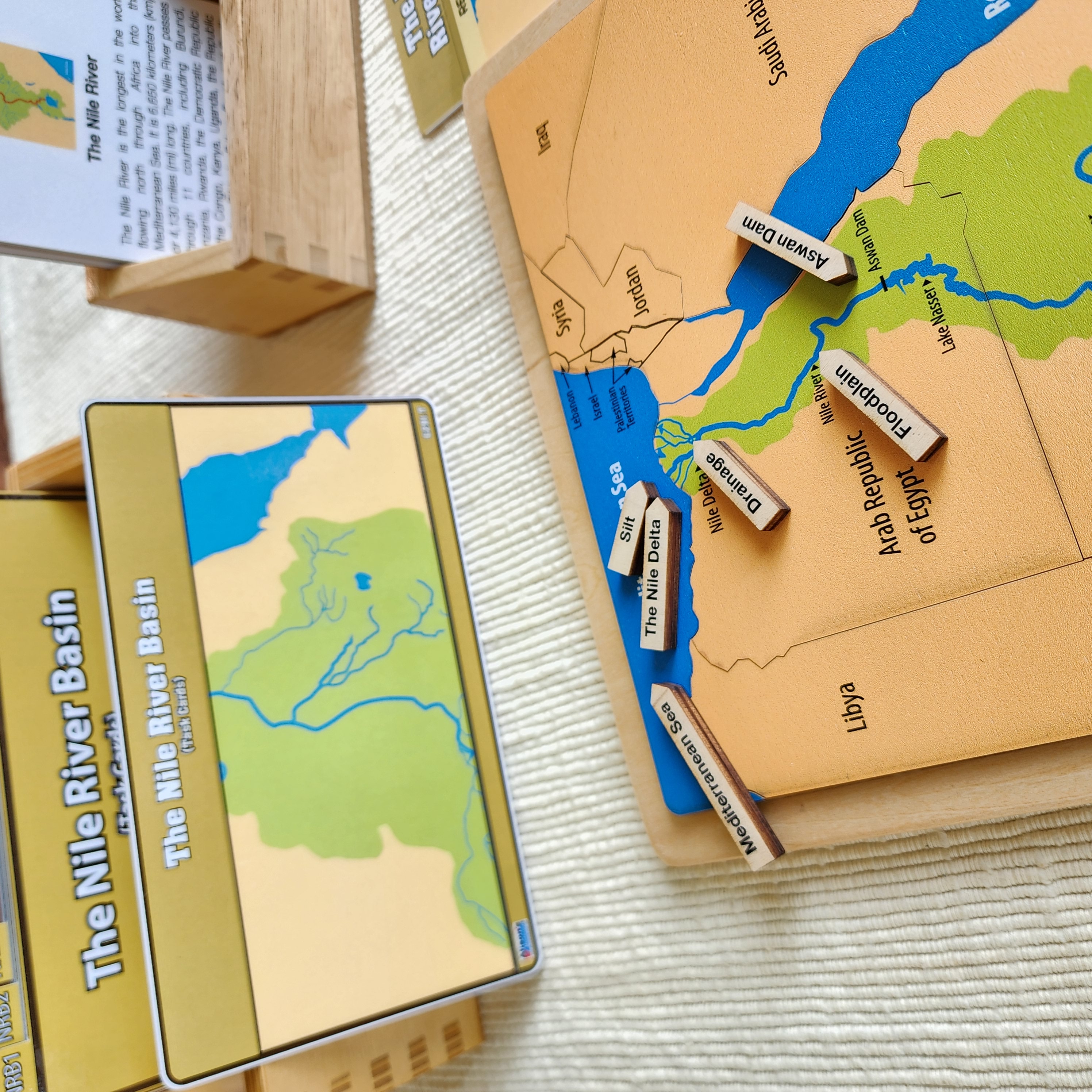
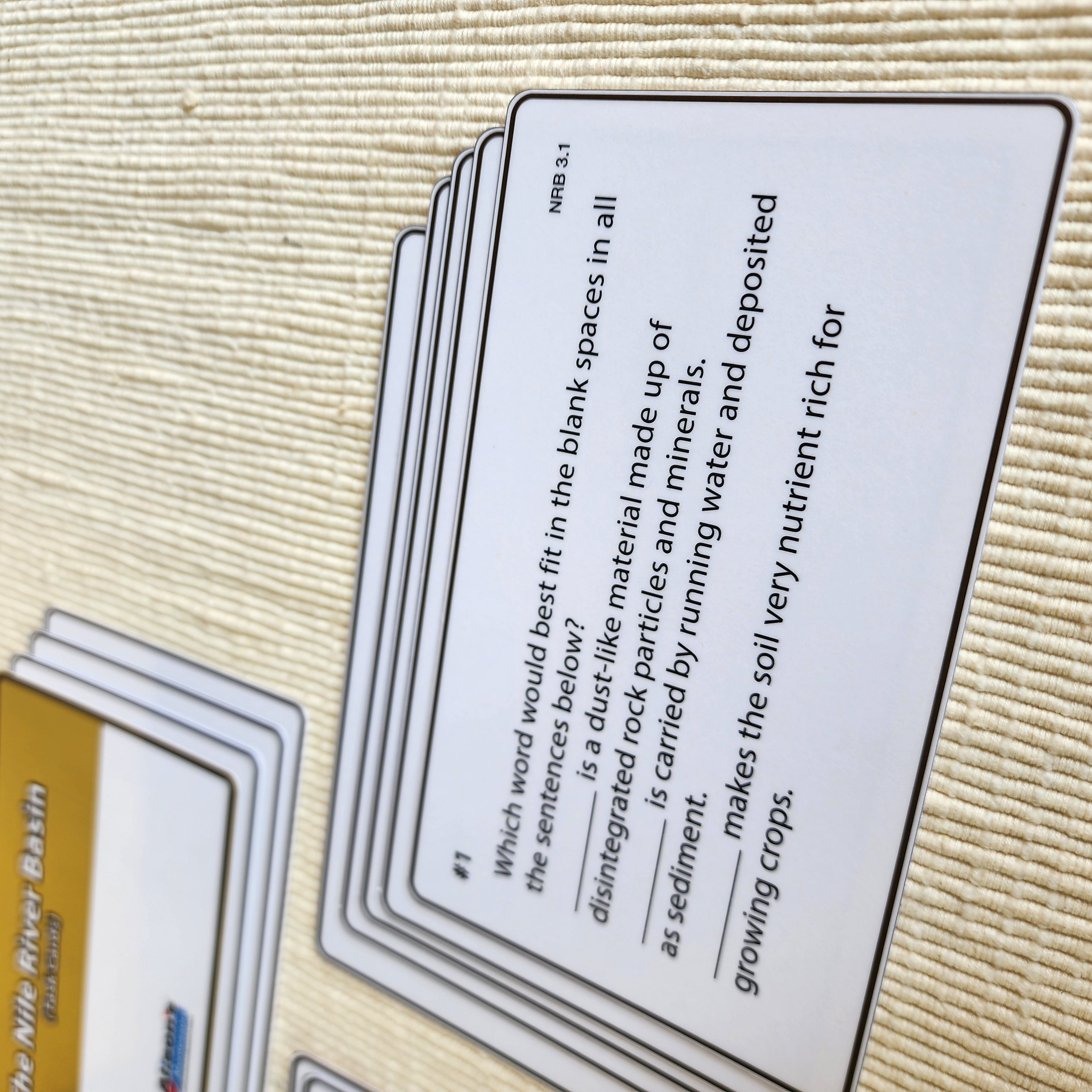
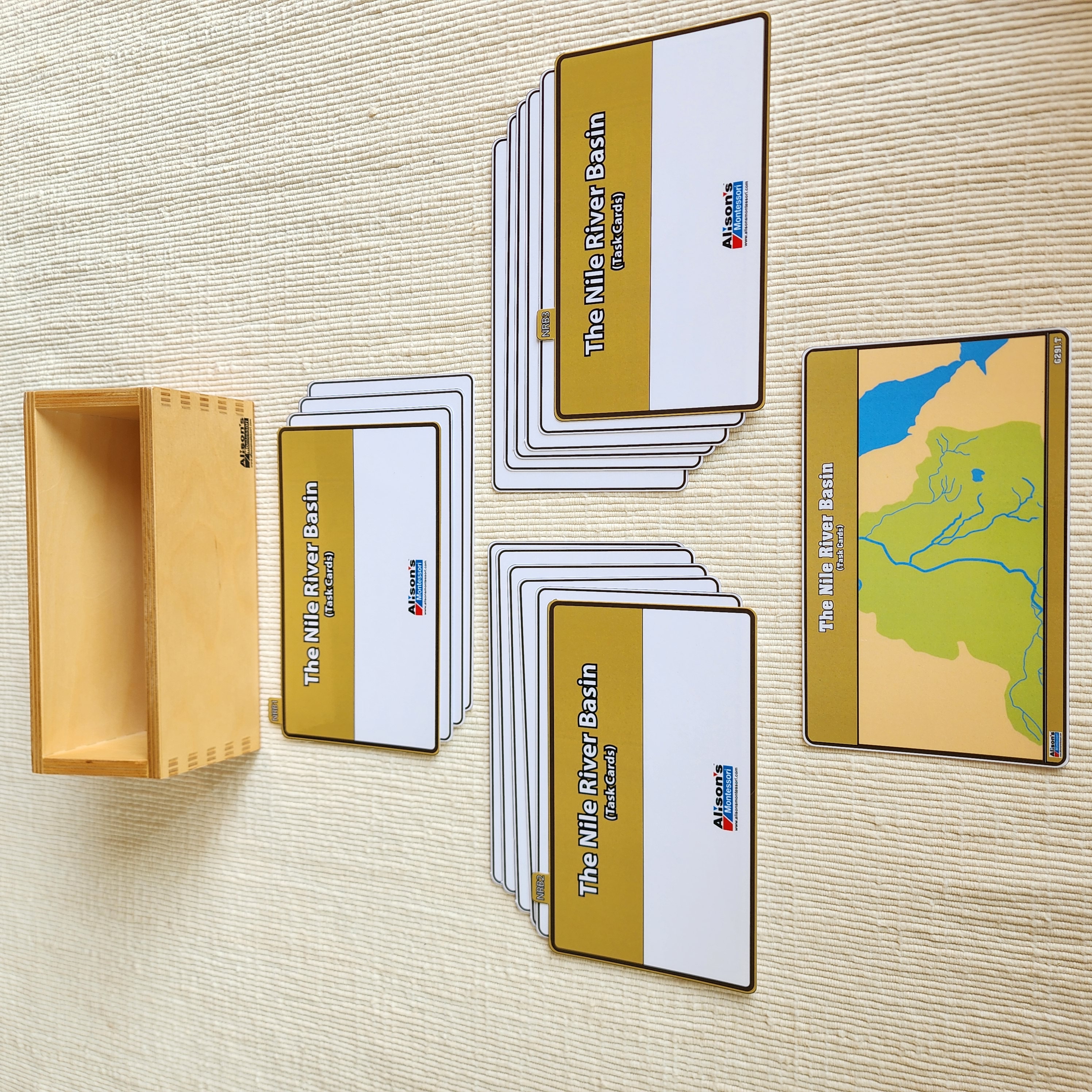
The Nile River Basin Task Cards help learners focus on key information. Learners are asked to observe the puzzle and recall knowledge acquired through the Research Cards. After working with the Research Cards and Task Cards, learners will be able to locate parts of the Nile River, features such as dams, cataracts, tributaries, floodplains, drainages, irrigation, and lakes. They will also be able to explain the benefits and cons of certain features and name more countries related to the Nile River Basin.
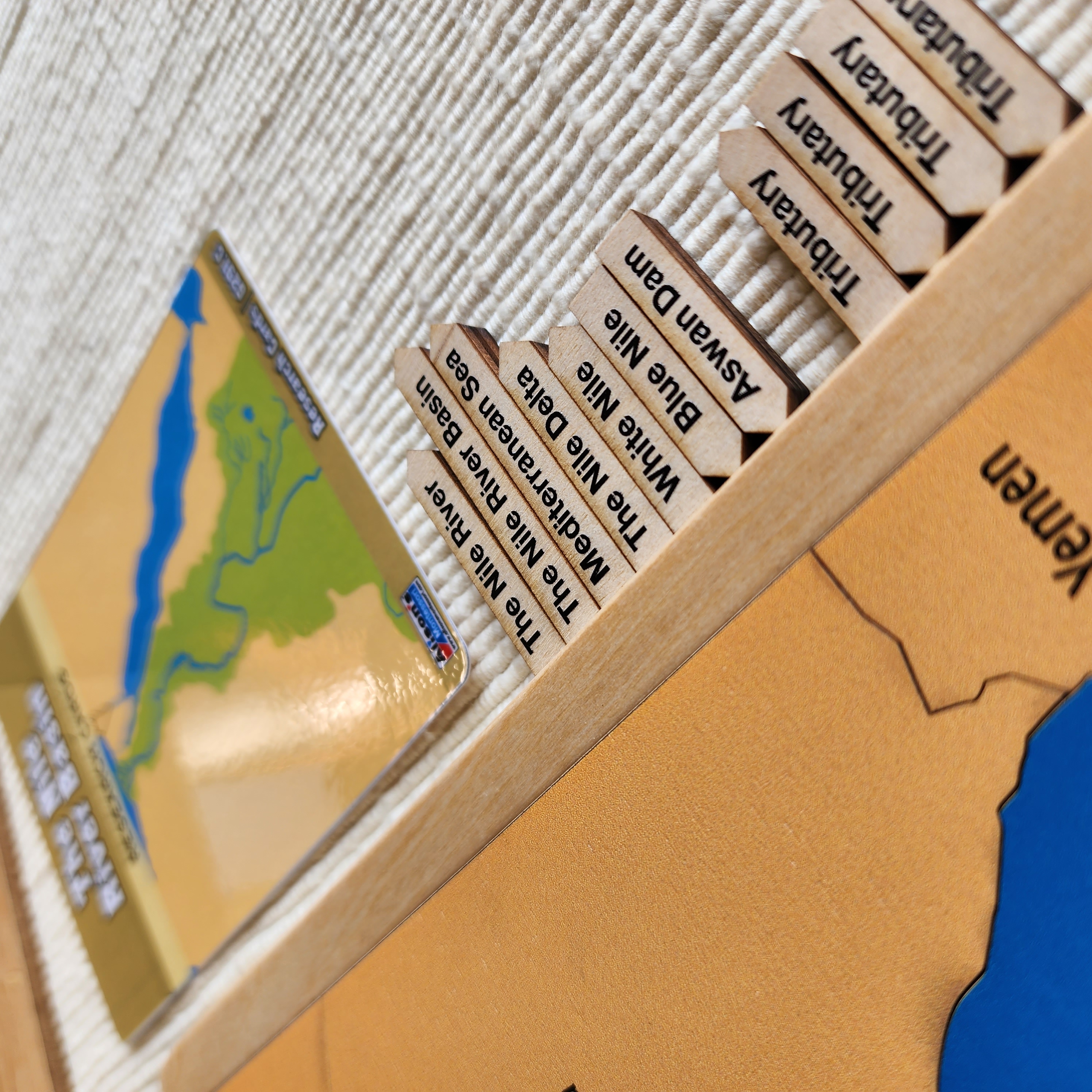
Using the wooden labels with the puzzle while reading The Nile River Basin Research Cards helps learners keep engaged and visualize the features specified on the cards. Learners use the control chart and must pay attention to small details, which help distinguish different features.
The Research Cards contain colorful images with red markings to highlight key features. The vocabulary is rich and age-appropriate, just enough to reactivate existing knowledge and add new key vocabulary!
In conclusion, we highly recommend our newly developed materials on the Nile River Basin as they will offer your learners a new insight into Africa and its fascinating geographical features! For more Montessori materials, visit our website at www.alisonsmontessori.com.