Geography
Glaciers can be found on nearly every continent. Some of the most famous glaciers are the Lambert Glacier in Antarctica, the Perito Moreno Glacier in Argentina, the Margerie Glacier in Alaska, the Furtwängler Glacier in Tanzania, the Fox and Franz Josef Glaciers in New Zealand, the Pasterze Glacier in Austria, and the Biafo Glacier in Pakistan. For many centuries, humans have ventured through mountainous regions, not knowing that some were the work of moving ice. Dr. Montessori highly valued the power of water for this reason; water is calm and strong.
Why study glaciers?
The study of glaciers is part of the Montessori geography curriculum. Glaciers provide drinking water. They are part of the water cycle, as snowflakes accumulate and are compacted to form long-lasting blocks of ice. Fast melting glaciers can cause great harm to humans such as by causing the sea-level to rise and result in flooding. Glacial landforms are spectacular natural occurrences resulting from physical forces such as gravity, erosion, and abrasion. As children learn about water and wind, they will observe how powerful water and wind can be, and how they contribute towards shaping the surface of the Earth.
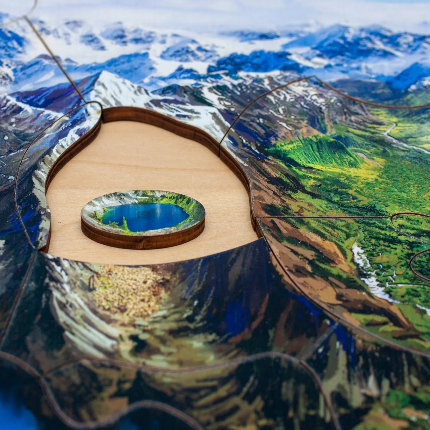
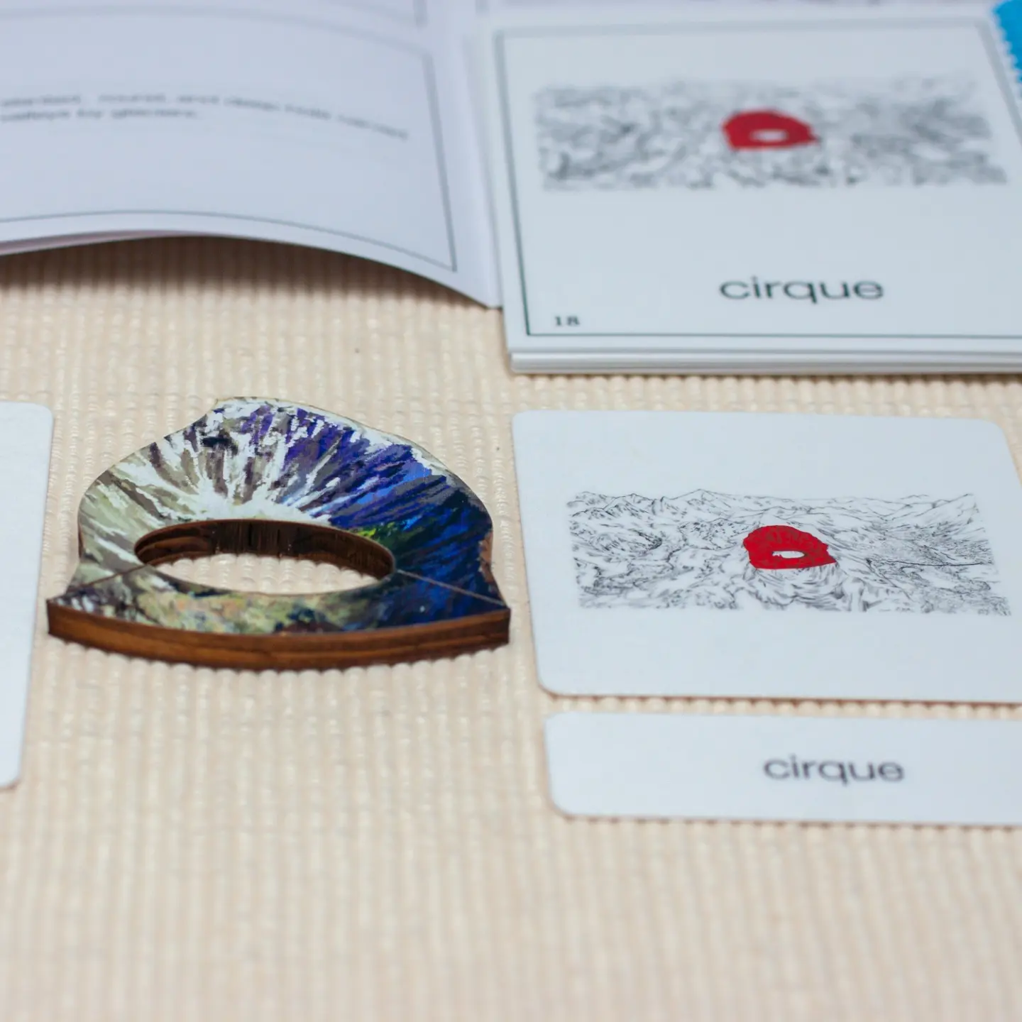
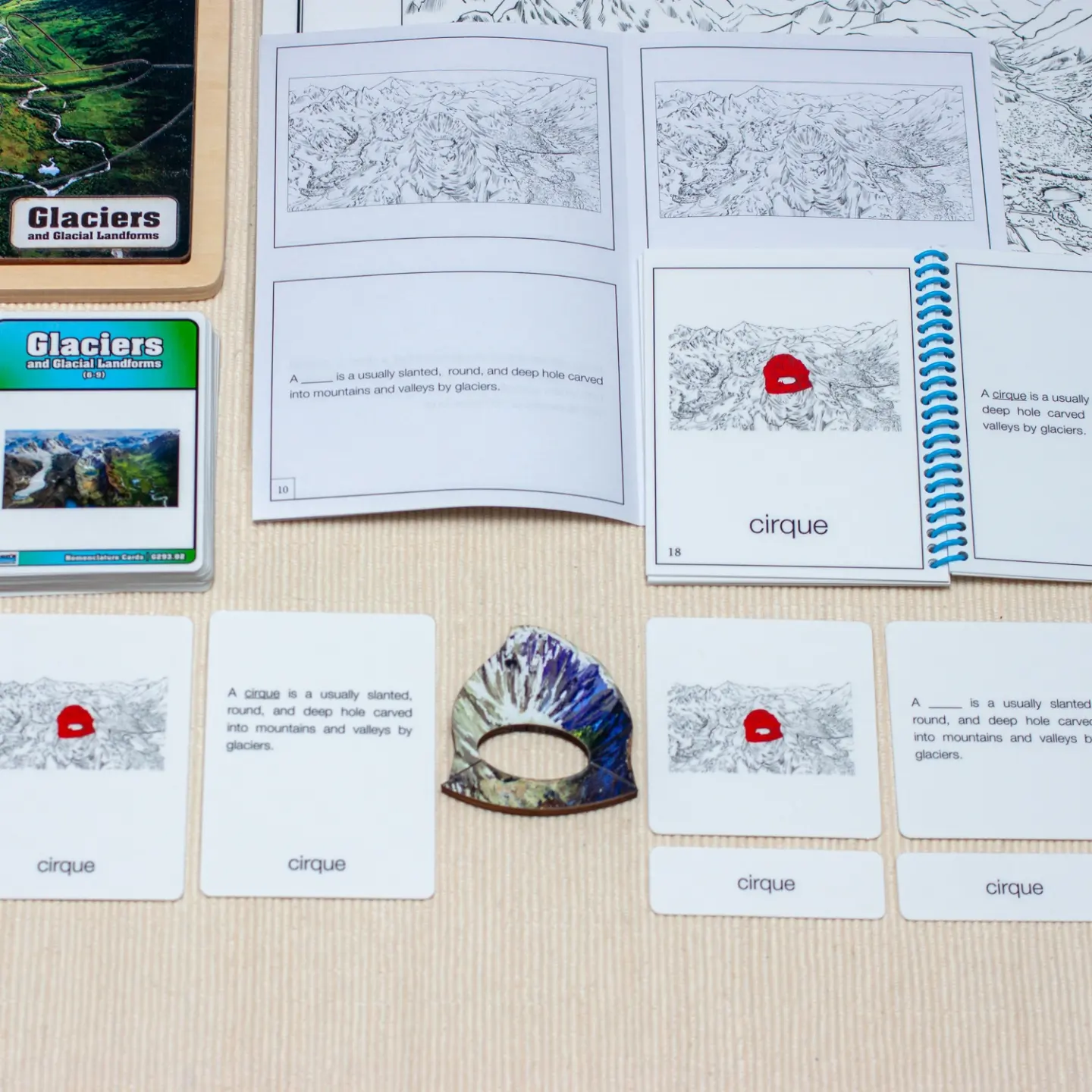
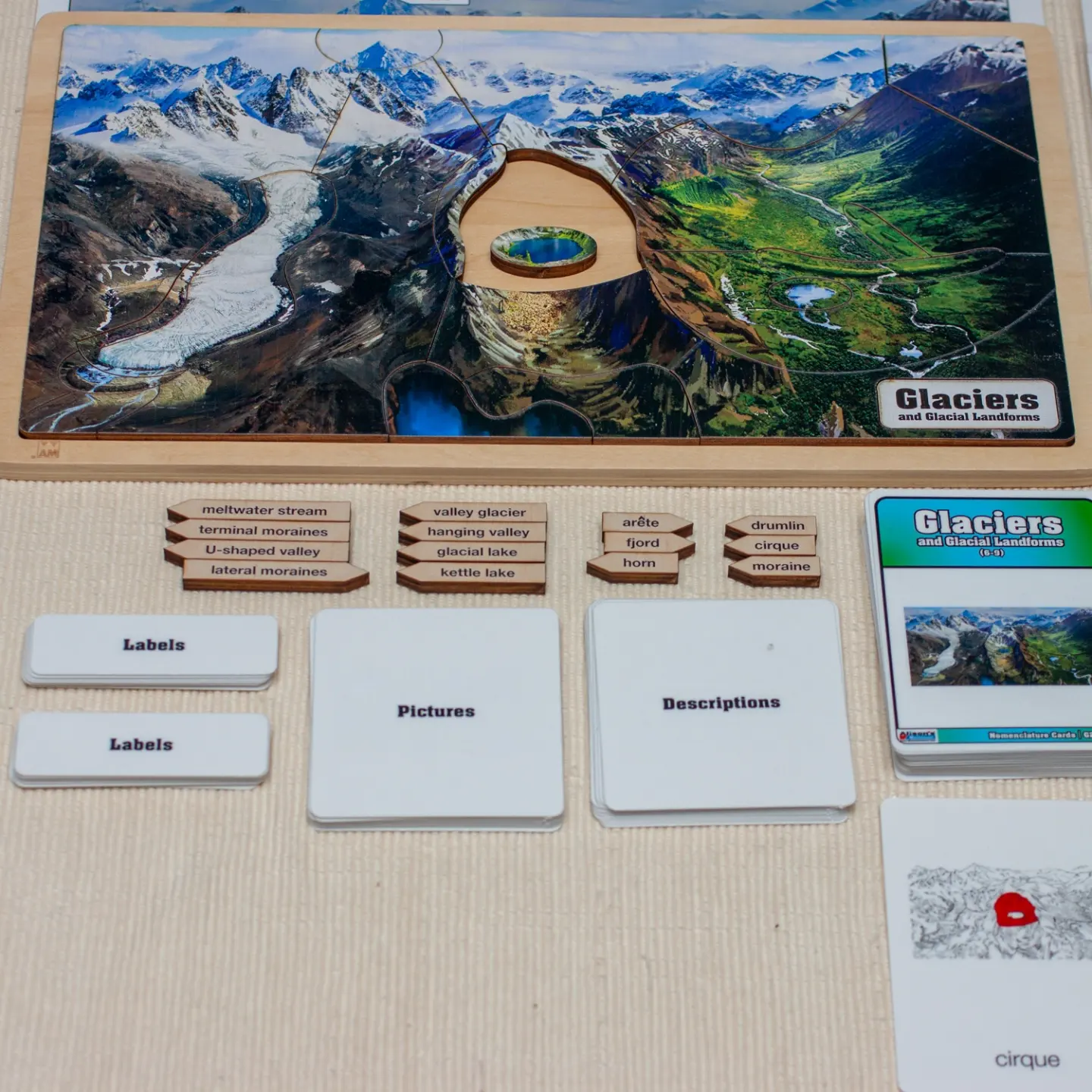
What are the most apparent parts of glaciers? Perhaps the most notable part of a glacier is the cirque, at the top of a glacier valley. A cirque is a depression on the side of a mountain caused by accumulated snow that underwent temperature changes turning it into ice. With the force of gravity, the ice begins to descend, plucking rocks on its way, leaving a steep slope behind. Other glaciers’ most distinctive features are aretes and horns. Aretes are the thin sharp circular crests of rock surrounding cirques. A horn occurs when glaciers erode three or more aretes leaving a narrow peak above the glacial valley. Finally, you will find some lakes such as kettle lakes. Kettle lakes, just as the name indicates, are pools of former blocks of ice that created depression and melted.
Materials
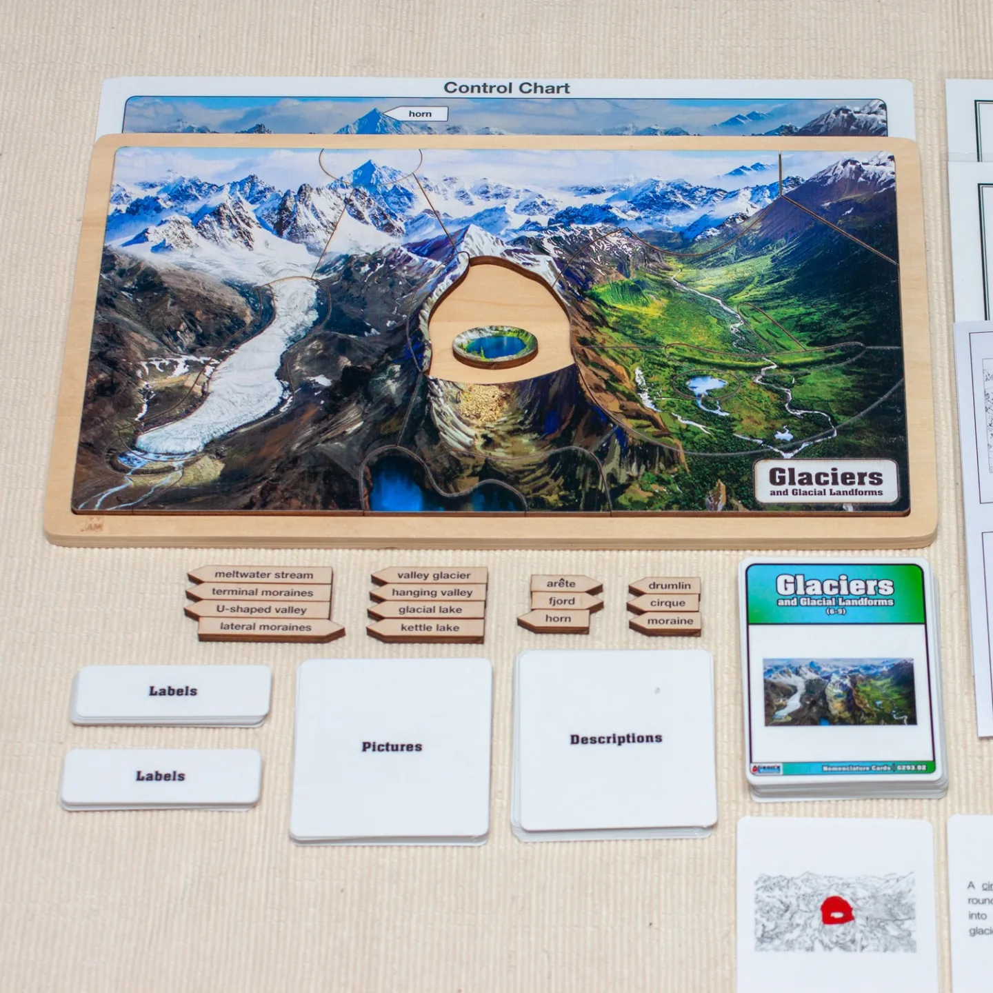
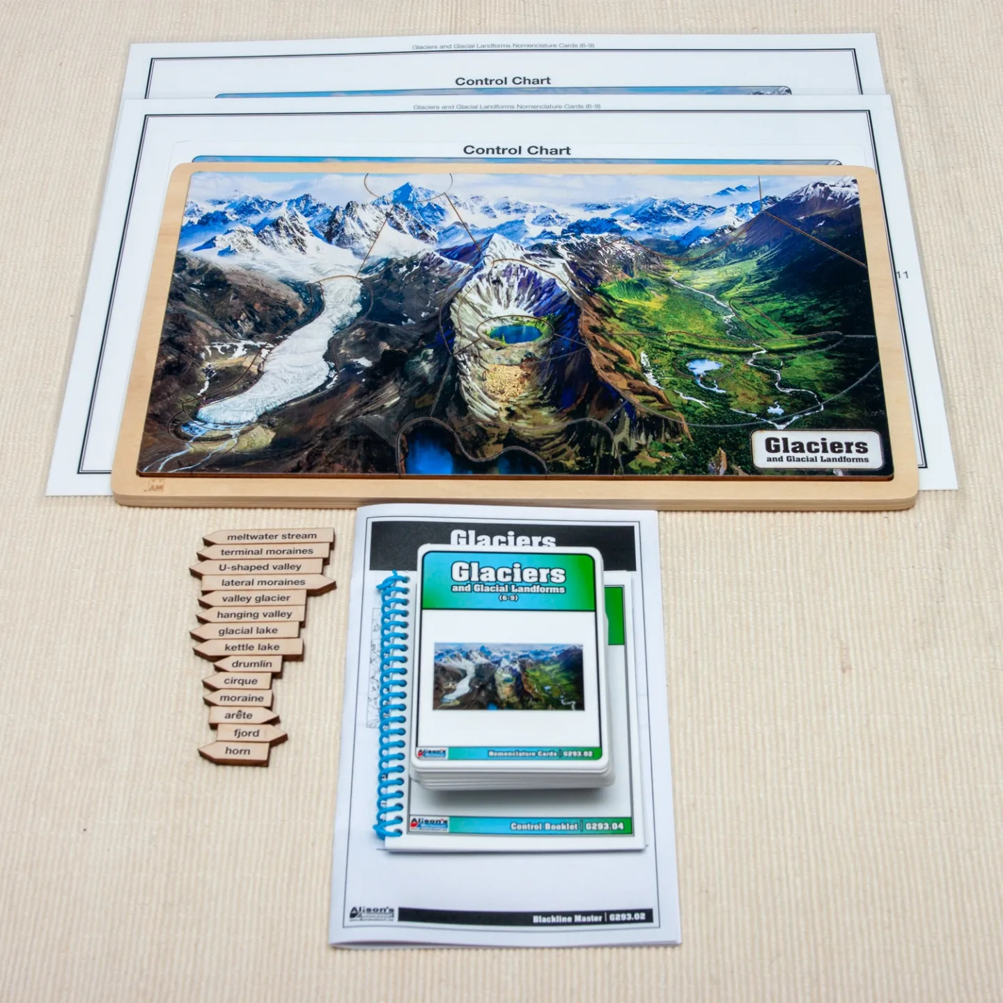
- Glaciers and Glacial Landforms Puzzle
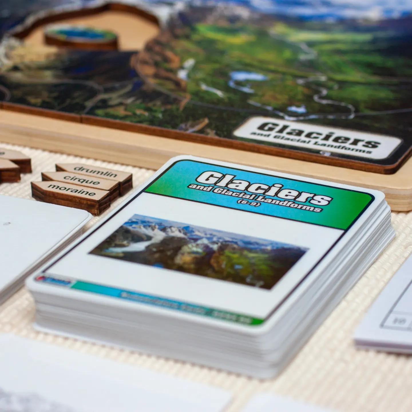
- Glaciers and Glacial Landforms Nomenclature Cards (3-6)
- Glaciers and Glacial Landforms Nomenclature Cards (6-9)
How to Use the Materials
You may collect pictures of different mountains to introduce the topic. Have children describe some of the characteristics of a mountain (snowy, pointy, rocky…) Discuss local mountains and determine if they have glacial features. Then use a map or a globe with reliefs to show their locations. You may introduce the Glaciers and Glacial Landforms Puzzle which will allow children to separate each part of the glacier valley. The left side represents an active glacier region with a valley glacier, lateral moraines, a terminal moraine, and a meltwater stream. The middle part of the puzzle represents a cirque and depicts how glacial lakes form as a result of melting snow accumulating in a depression at the base of a cirque. You will also see a hanging valley, which feeds the fjords and U-shaped valleys. On the right part of the puzzle, children can visualize a green valley with a stream of water and kettle lakes.
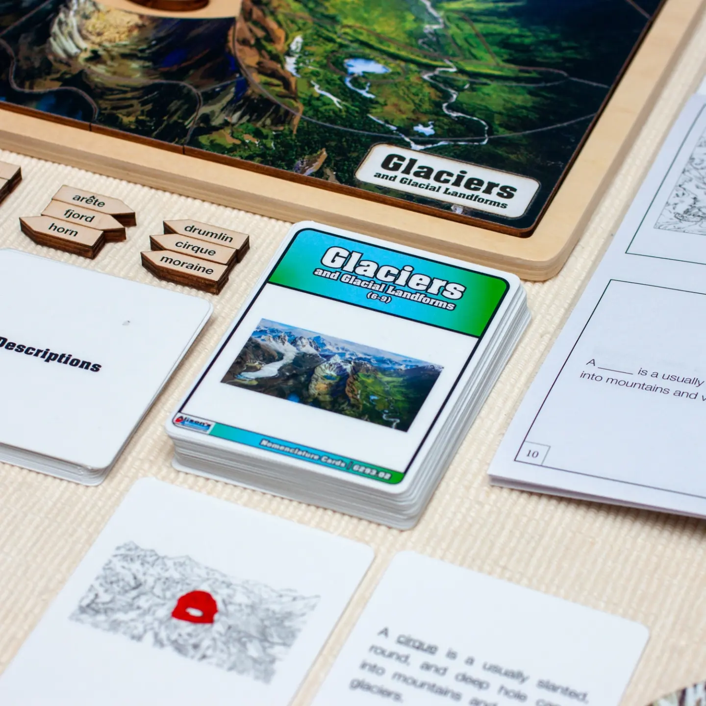
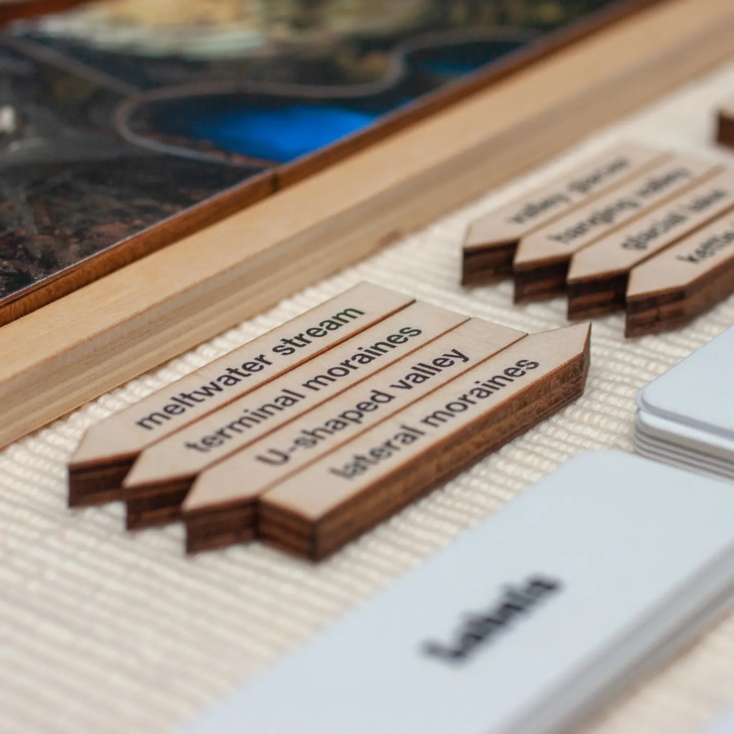
As you introduce each part of the puzzle, read the Glaciers and Glacial Landforms Nomenclature Cards 6-9. Place the control cards (picture/label) in a column and invite children to make the picture and label to the control card. Later, when children feel comfortable with the description of each part, they can practice reading fill-in-the-blank cards and match them to the control cards and label cards. As an extension, you may leave copies of our reproducible materials (booklet and backline master).
Children can use a 3-fold corrugated project display board to present facts about glaciers. They may also create glacial landforms using air-dry clay or salt dough. We hope Glaciers and Glacial Landforms will inspire children to appreciate the force of nature and its spectacular landscapes.
Please visit our website for more geography puzzles!