We are excited to offer our complete state study of the United States of America. Our new USA State Study Complete Set is a unique approach to learning about each state. In a Montessori learning environment, children are introduced to physical geography at age 4, starting with the whole world then moving to the smaller parts of the world. This provides them with a context to realize where they are situated. For example, children learn to distinguish land from water using the Montessori sandpaper globe and land and water form trays. Later they will learn about the continents using the Montessori continents globe and puzzle map.
Around ages 6-7, children should have received sufficient preparation to be formally introduced to the states of the USA. They can work using the classic US puzzle map from the geography cabinet. In addition to the puzzle map, children will find our exclusive USA State Study Complete Set quite engaging and educational. The set includes a variety of manipulatives that will satisfy many learning styles. It contains a wealth of information on the topic, and is designed in a Montessori-aligned format. Which facilitates children so they can work at their own pace.
How to Use the Materials
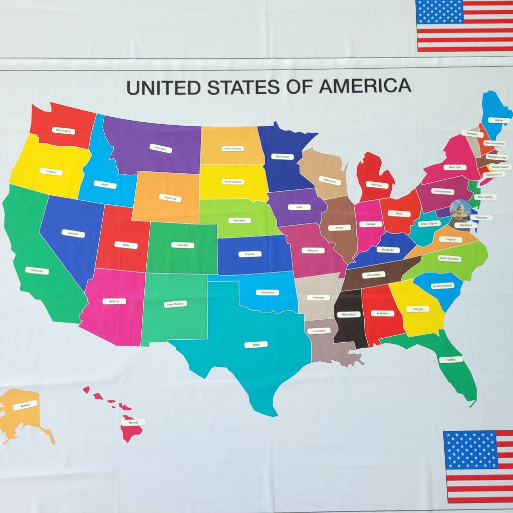
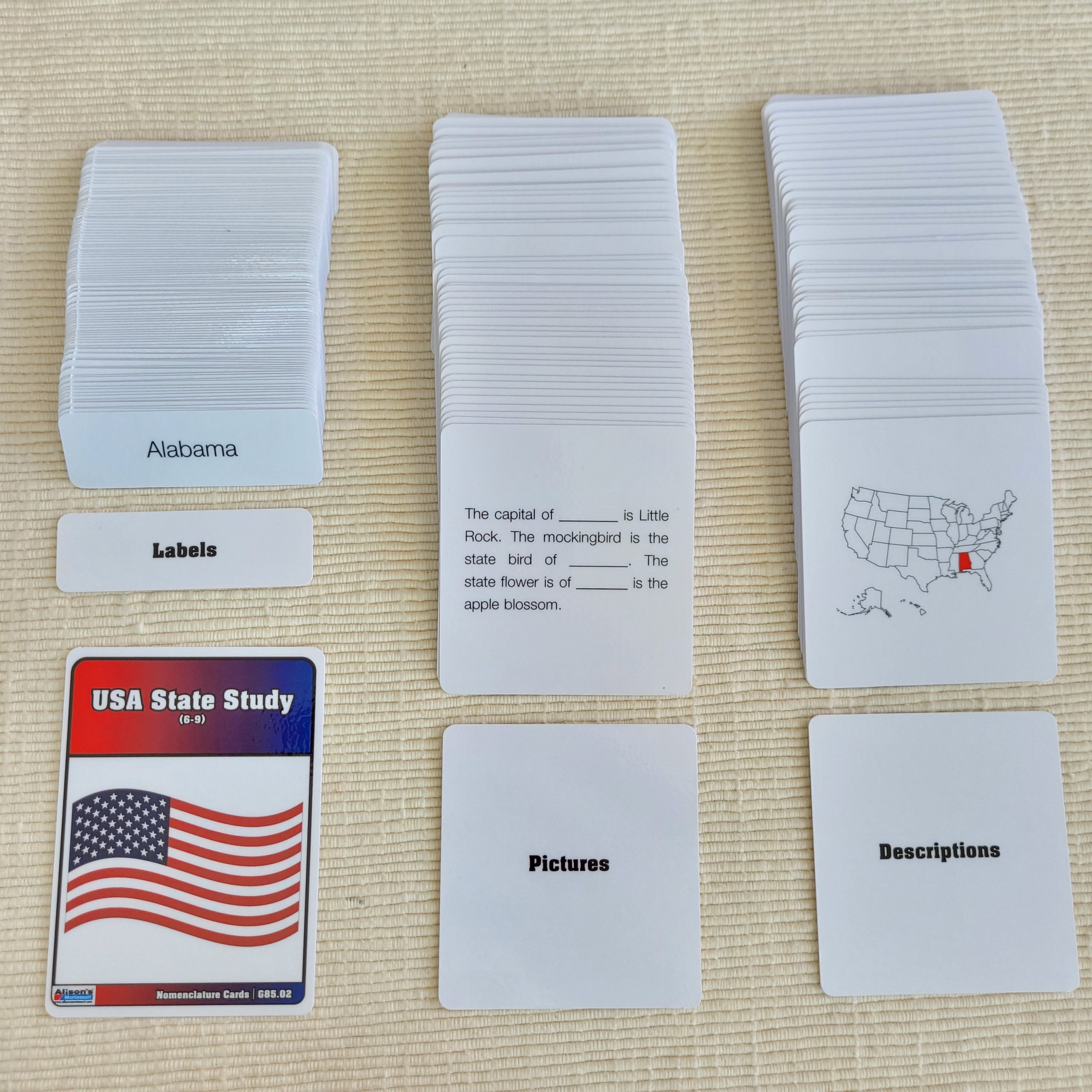
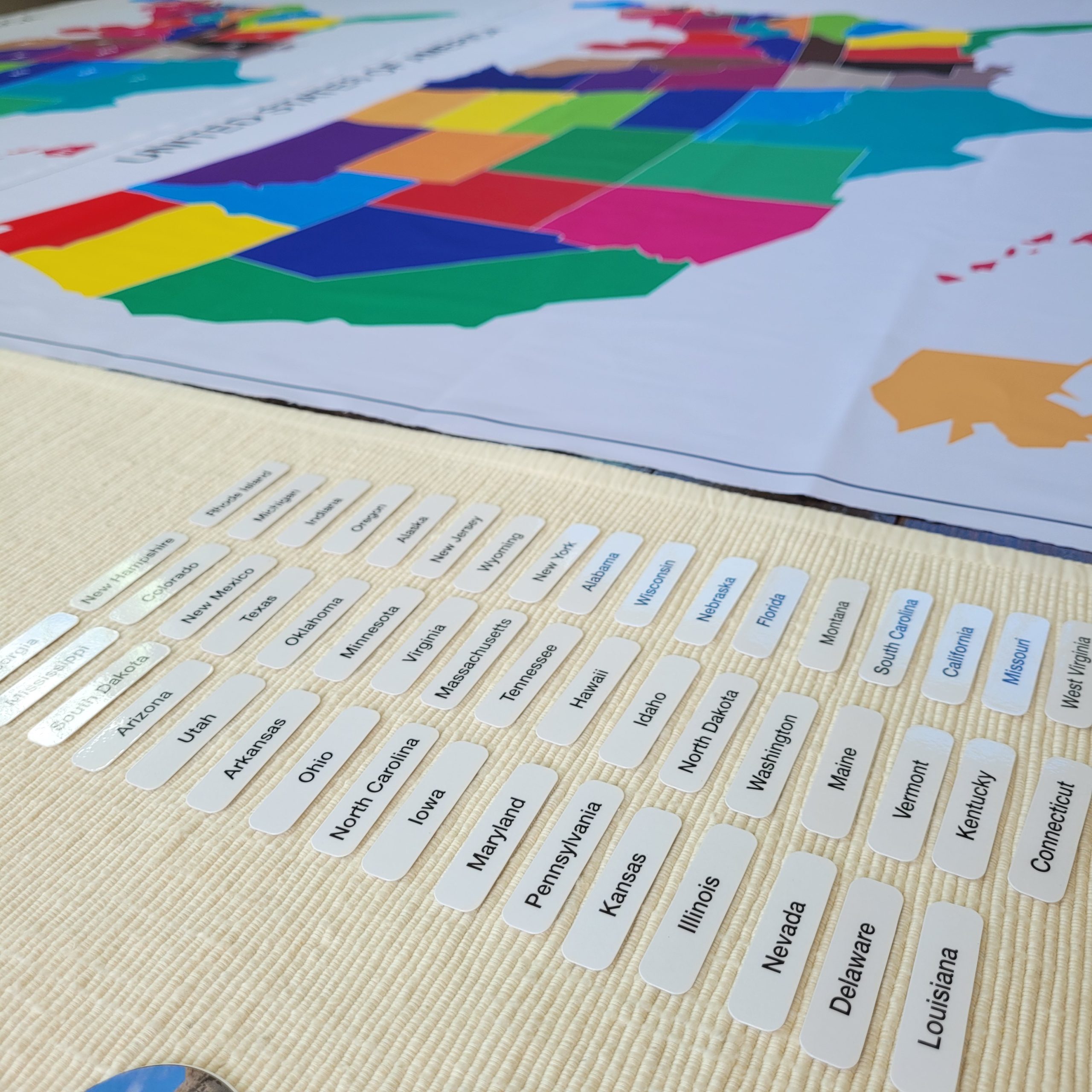
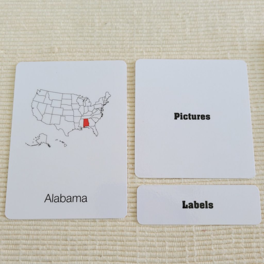
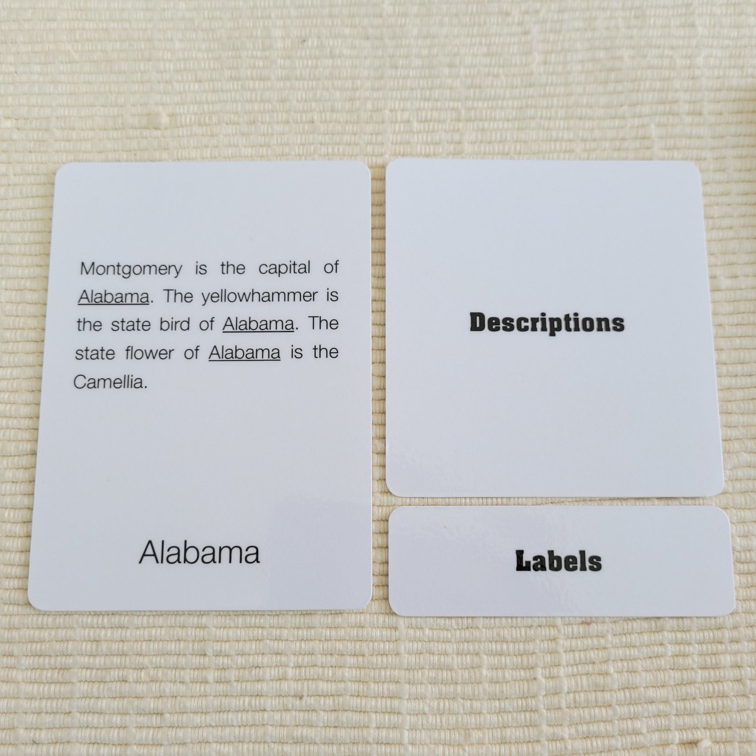
Children may have had prior exposure to the states names and should be able to start working with the Informed Chart. Invite a small group of children to match the labels, the ones containing the names of the states, to the Informed Chart. You can work with 10-12 states at a time, especially large states clustered together. This helps children make spatial associations (Washington is above California), and work with a more manageable amount of knowledge. Once children can locate the states, you may work with the Nomenclature Cards of the corresponding states. Begin by placing one card (picture/label) at the top left corner of a mat, reading the corresponding card (description/label), and place it to the right of the picture/label card.
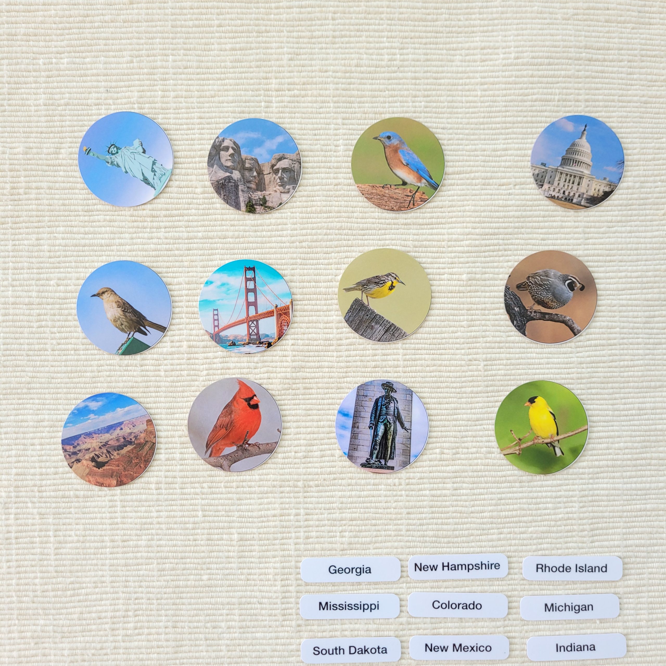
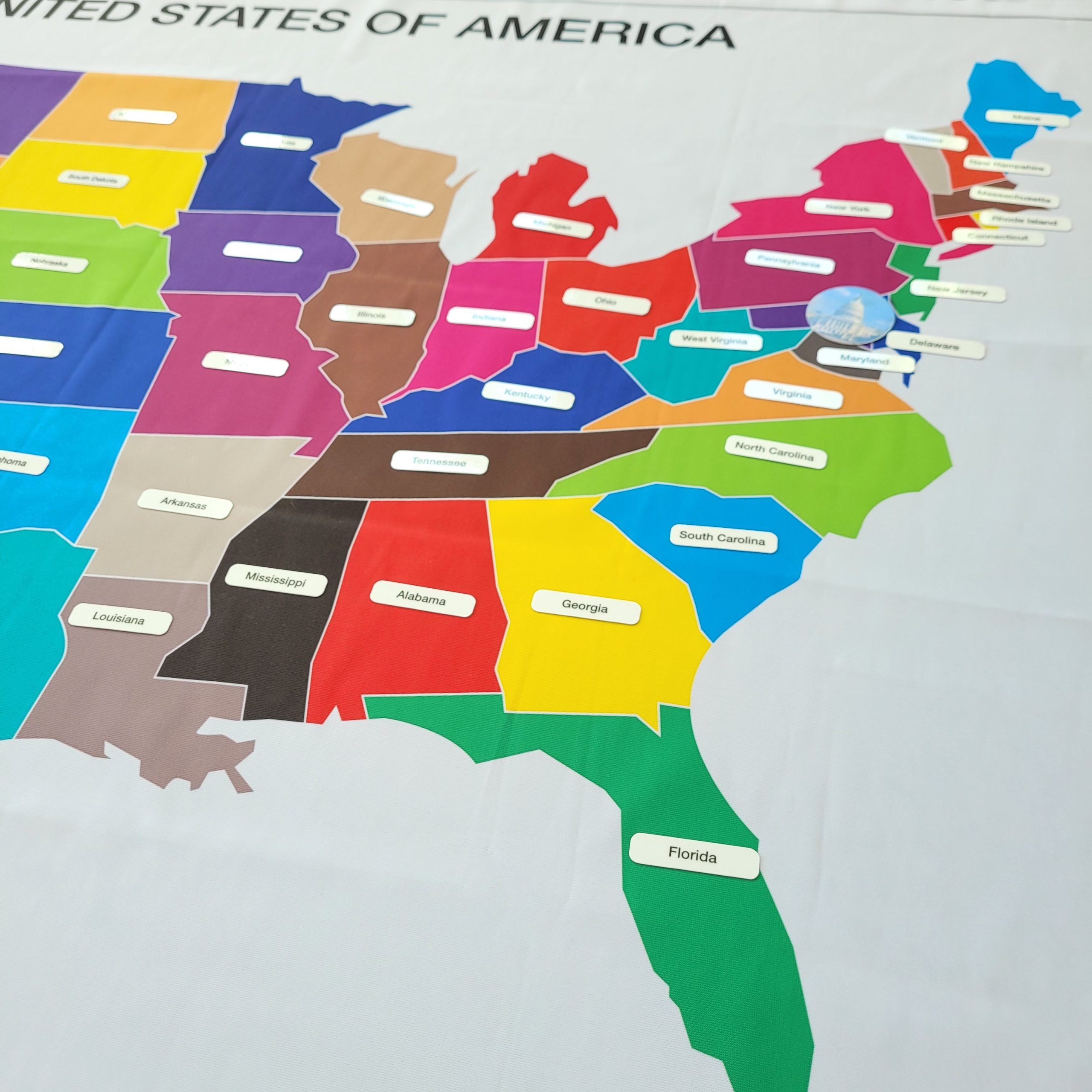
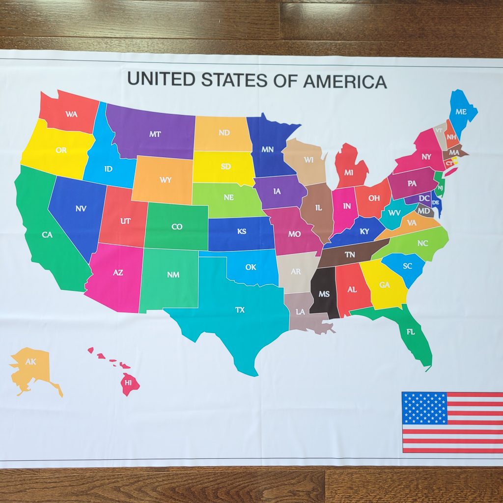
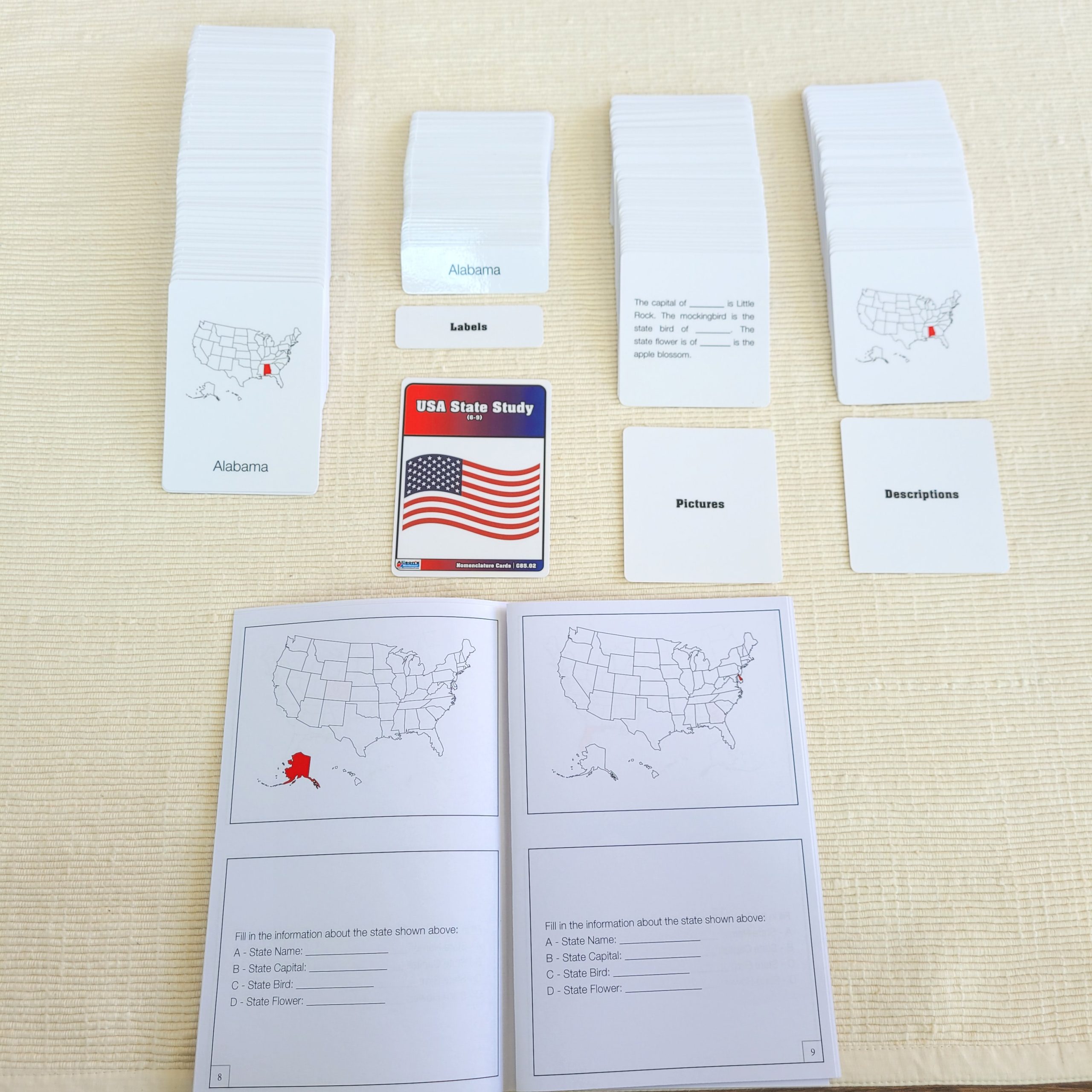
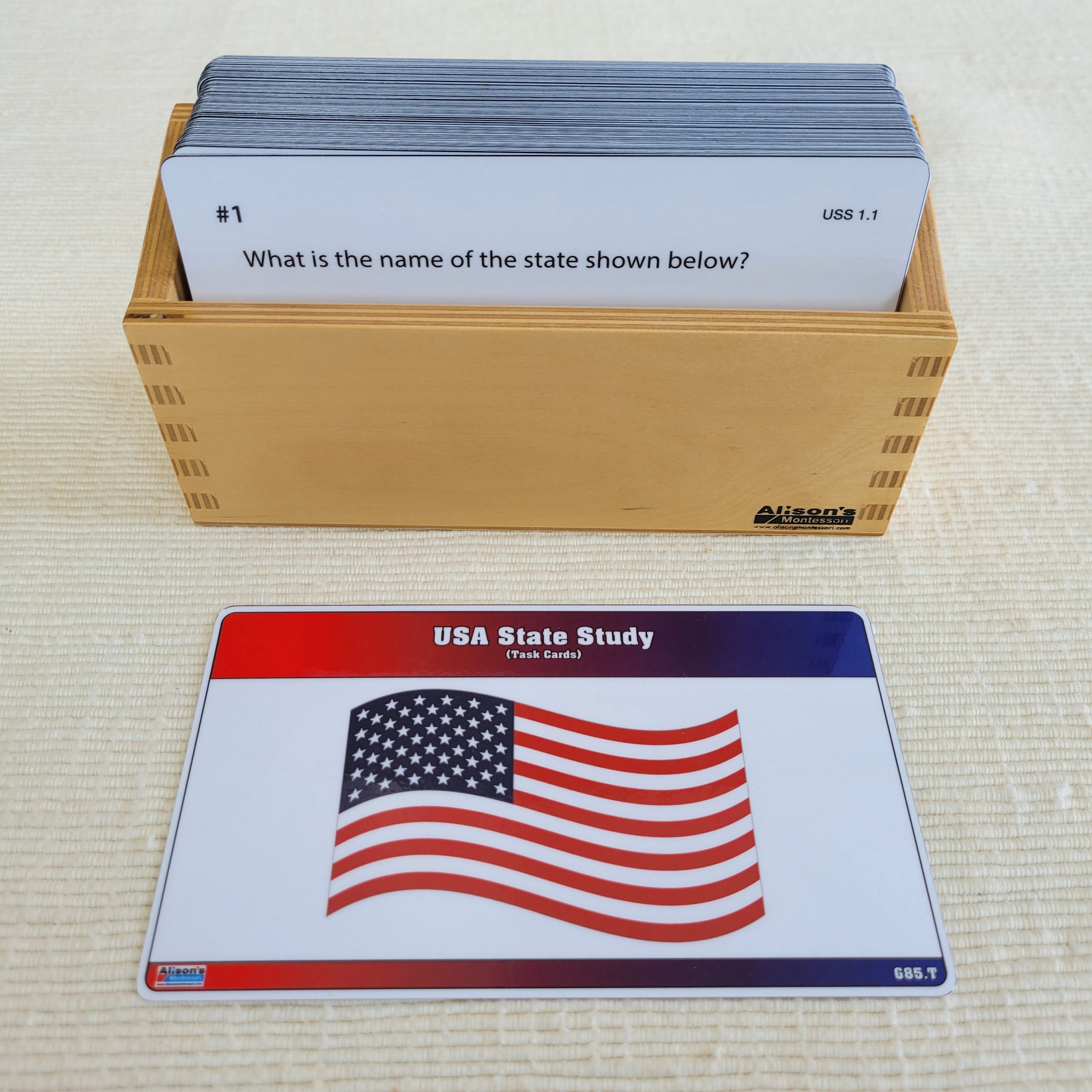
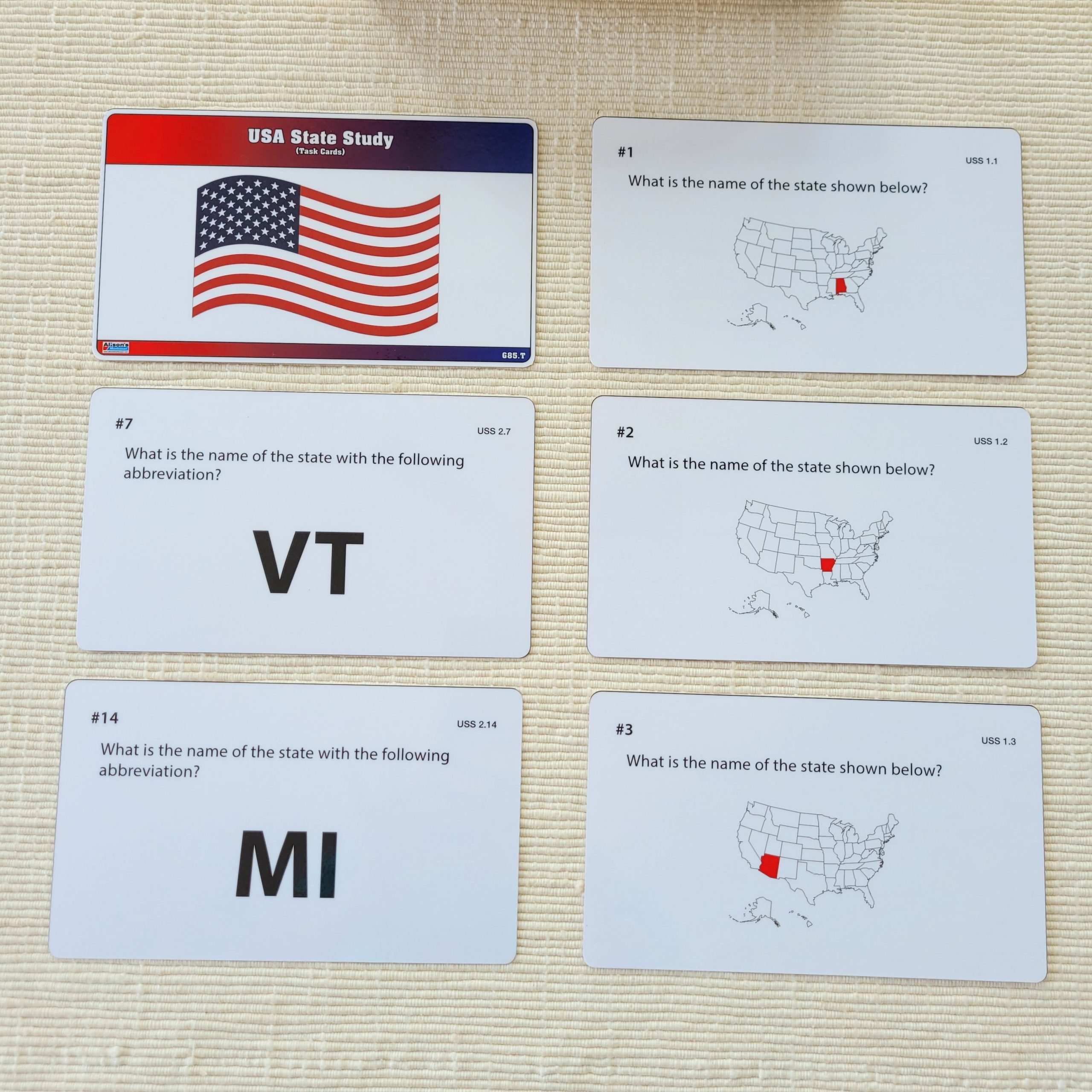
Later, children can assess their knowledge by matching pictures or description cards to labels. Some state birds, flowers, and landmarks can be found in the disc-shaped cutouts and placed on the Informed Chart. You may present 10-12 states per day for 5 consecutive days and allow time for independent practice each time. Once all the states have been studied, children may have the choice to match the chart labels to the Mute Chart by placing the Informed Chart out of sight or to work with the USA State Study Task Cards.

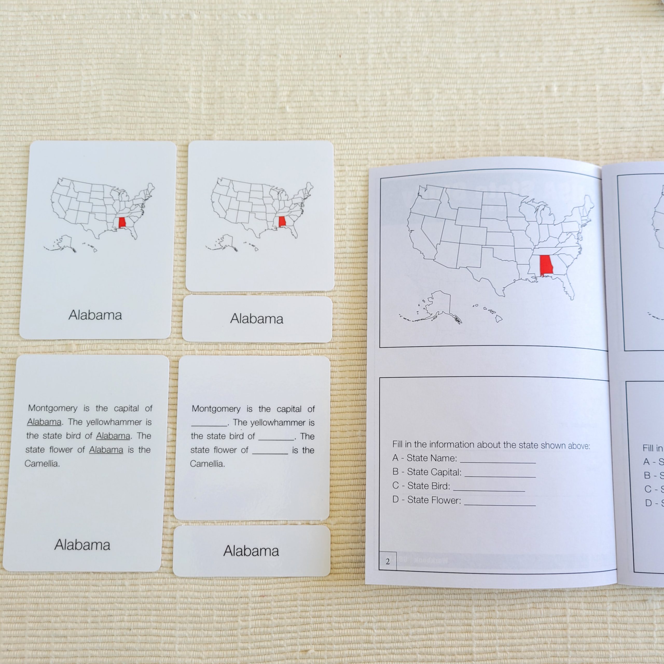
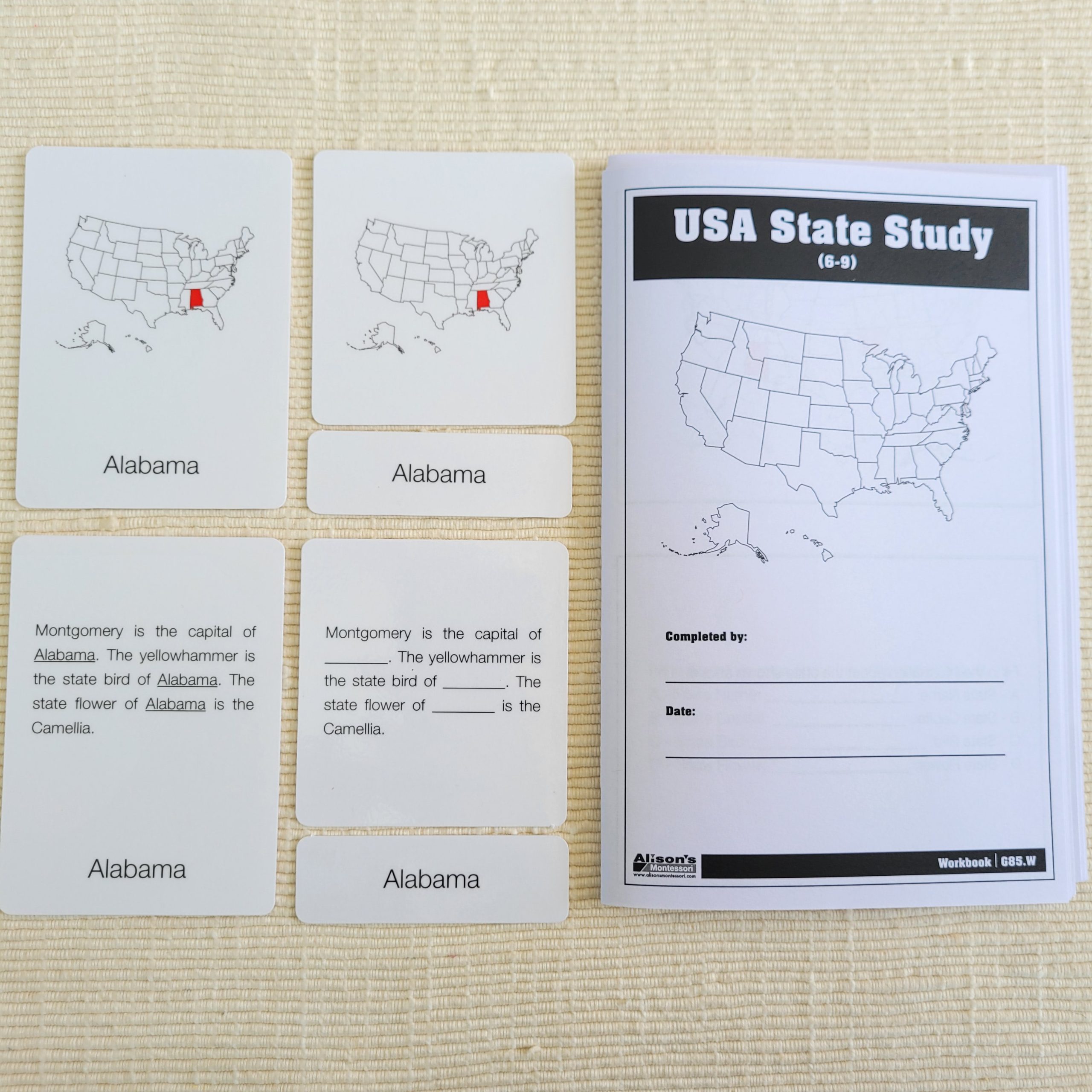
Finally, when children feel comfortable with the materials, they can assess their knowledge using the USA State Study Nomenclature Cards Workbook. The Workbook contains 26 pages, each page has a blank map of the US on top and a cloze test at the bottom. Children can color the map to show where a given state is located and write information about the state capital city, official representative bird, and flower.
USA State Study Complete Set is a comprehensive study of the state, their capital cities, state birds, and state flowers in an engaging manner. The material is excellent for individual or group work and is adaptable to multi-aged groups of learners. Children can reinforce what they have learned by creating and labeling their own maps, or researching and presenting a state of their choice.
For more educational and Montessori materials, visit our website at www.alisonsmontessori.com !